|
|
|
|
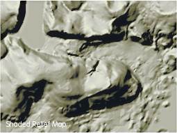
Surfer
rocks! Golden Software, Inc. designed Surfer 8 for
serious analytical work, but you don't need to be an engineer
to enjoy the maps produced by the program.
The
free trial version is remarkably functional. It renders
beautiful 3D images from digital elevation matrices that
you can easily download from the Internet. You have complete
control over the orientation of the view, color gradients,
line density and other factors. Wire frame views can be
made to look like engravings.
Following are a few ideas to help you begin exploring Surfer's
potential.
|
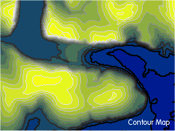
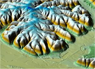
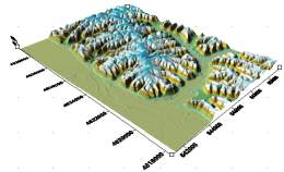
- Double click any of the
DDF files, and Surfer will create a surface something
like this image:
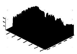
- In situations like this
one, you will need to reduce the vertical "Z-scale"
exaggeration. To make the adjustment, either double-click
or right-click the image and choose "Properties".
The following box opens:
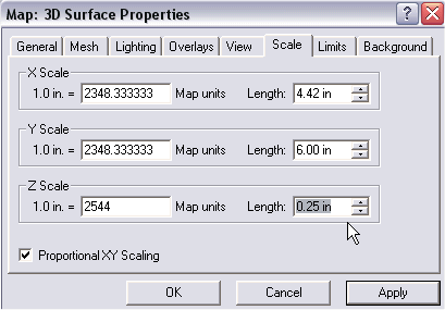
-
Under the
"Scale" tab, change the "Length"
of the Z factor to a smaller value to bring the peaks
down to a more realistic size. You may need to enter
a value as small as .10 to get a realistic view, although
some vertical exaggeration can be useful. The 3D surface
will be redrawn:
|
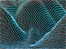
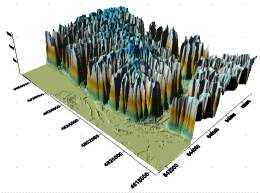
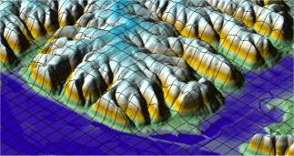
-
Note
that when you start a wireframe, Surfer will initially squeeze
the entire grid into a very small area, creating a dense black
view (below left). You'll need to adjust the z-scale as above
and then zoom into an area of interest for a workable image.
The magnified image on the right shows a small section displaying
the x and y lines. In this example, colors were inverted and
adjusted through post processing
in an image editor.
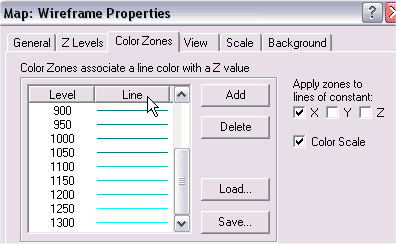
-
You control which wireframe
lines to draw (x, y or z) through the "General"
tab in Wireframe Properties dialog. To add line color that
changes with elevation, click on "Line" under the
Color Zones tab. That will open another box where you can
set the minimum and maximum elevation colors. Surfer will
automatically create a color line gradient from bottom to
top:
The rich set of
options make the program a cartographer's playground.
Surfer has many
other functions ...experiment with the program and check the
online help system. Visit
Golden Software to learn more or to download the program.
|
|
|
|
|

 If
you download a SDTS DEM file, it will be named with
a format like "1693459.DEM.SDTS.TAR".
The "TAR" extension means that it's an
archived zip file. If you've been using Global Mapper
to view data, that program does not require the
TAR file to be unzipped. Surfer (and 3DEM for that
matter) requires that you unpack the "tar ball"
with a program like
If
you download a SDTS DEM file, it will be named with
a format like "1693459.DEM.SDTS.TAR".
The "TAR" extension means that it's an
archived zip file. If you've been using Global Mapper
to view data, that program does not require the
TAR file to be unzipped. Surfer (and 3DEM for that
matter) requires that you unpack the "tar ball"
with a program like