|
|
|
Data
There
is a wealth of free data available on the Internet,
but be realistic about what you try to download. If
you have an ordinary analog dial-up modem, you will
be less frustrated by using small data sets. For example,
Digital Line Graph (DLG) files showing roads and streams
or 30-meter resolution Digital Elevation Models (DEM)
are often only 200-300KB in size, which are easy to
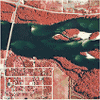
download. Single TerraServer aerial photos will generally
load well with a standard modem link. USGS topographic
maps (DRG files) are about 2MB in size. Landsat images
and Space Shuttle Radar DEM files are typically 30MB
and larger, requiring a broadband connection. In addition
to free data, many of the following sources offer
inexpensive commercial data.
|
 |
- Need the latitude/longitude
of a location to begin your data search? Check here:
- TerraServer-USA®
- Aerial Photos and Topographic Maps. HINT:
Use the program
USAPhotoMaps to simplify downloads from
TerraServer.
- USDA
GeoSpatial Data Gateway - Very nice download
site that will batch the requested GIS data files
by county or US state. Includes DRG, DEM, soils,
TIGER vector layers, climate data, LULC, ortho imagery
and more.
- USGS
Seamless Data Distribution Center - Uses a Java
map-based interface for selecting free, seamless
National Elevation Data (NED), Shuttle Radar Topography
Mission (SRTM), and National Land Cover Data (NLCD).
Rather than downloading files piecemeal, you outline
the area where you want coverage and the EROS Data
Center generates a custom file. This source is ideal
if you have a broadband Internet connection.
-
USGS Geographic Data Download - EROS Data Center
(DEM, DLG, NED shaded relief and other data). Parts
of this and the following site offer text-based
File Transfer Protocol (FTP) downloads that are
more modem-friendly. You can use Windows Explorer
procedures to copy a file on an FTP site and then
paste it to a location on your hard drive. An alternative
method is to use an FTP program (such as WS_FTP-LE)
to copy files.
- USGS
FTP Download Site for free DLG Data
-
USGS One Degree (30-meter resolution) Digital Elevation
Model (DEM) data - Click the map that appears
to locate and download data.
- MapMart®
- USGS partner offering free 10-meter and 30-meter
resolution DEM data (MapMart has a superb graphical,
map-based interface for finding data. For free
data, proceed through the ordering process to the
final download page.)
- ATDI®
- a USGS partner offering free Digital Elevation
Model (DEM) data
- GeoCommunity
- Free Digital Line Graph (DLG) and Digital Elevation
Model (DEM) data (Note: If you have a broadband
Internet connection, be aware that GeoCommunity
downloads are limited to about 5KB per second unless
you purchase a premium account.)
- Global
Change Master Directory - NASA
|
Midwest
State GIS Data Download Sites
|
|
|
|
Iowa:
|
|
Minnesota:

|
|
Wisconsin:

|
|
|

|
|
|
|
|
|
|
|
|
|
|
| |
| |
| |
| |
| |
| |
Map
Galleries
Other
Useful Sites
 |
|
 |
Top
of Page /
About
Commercial
logos or trademarks shown on the ForestPal web site
appear only to illustrate the products. The logos
and trademarks are the property of the respective
companies.
|
|
|
|


