|
To
begin using fGIS, you must open an existing project or type
in the name of a new map project.
An
fGIS project file saves:
-
A
table of contents of all your map layers with a record of
where the data are stored
-
The
layer properties that you set
-
Whether
or not each layer was turned on in the last saved view
-
The
last zoomed screen view
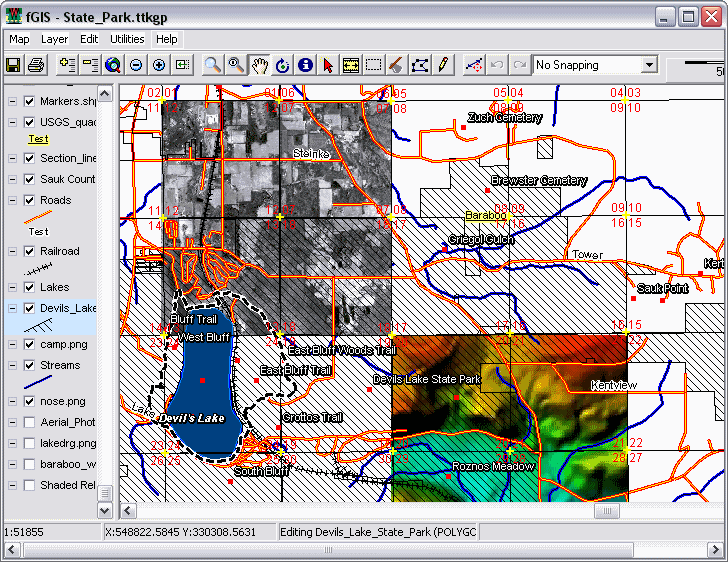
Before
you can create a new shape layer, at least one pre-existing layer
(either vector or raster data) must be added to the view. fGIS
will use use the first layer to establish a world space. As an
example, you might want to download the fGIS State_Park.zip
project to experiment with. It uses the Wisconsin Transverse Mercator
projection, but fGIS will work with spatial data in any uniform
coordinate system. To save download time, low resolution imagery
is provided in the zip file, about 3 MB.
Screenshot of the fGIS State
Park Project File
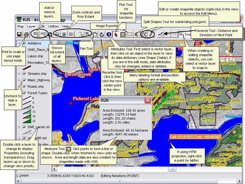
The
following diagram provides feature highlights. For more detailed
explanations, see the main Help
Index.
|