|
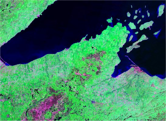
This
Landsat image shows Lake Superior and the Apostle Islands off
the tip of the Bayfield Peninsula in Wisconsin.
Landsat
false color images reveal various types of land cover. Each pixel
in a full-scale Landsat image represents about 30 meters. The
images are generated by computers based on reflected and emitted
electro-magnetic energy detected by sensors in the Landsat satellite.
While traditional optical imagery utilizes three bands of energy
(red, green and blue light), Landsat and other hyperspectral sensing
measures energy in six or more bands. As a result, Landsat images
can detect and distinguish features not apparent in conventional
photography. Coverage for most of Earth is available in MrSID
compression format from NASA and other sources (see Links).
Back
|