|
The UTM (Universal
Transverse Mercator) coordinate system used by USGS for TerraServerUSA
images is a method for minimizing distortions when representing
a globe on a flat surface.
Here's how it works:
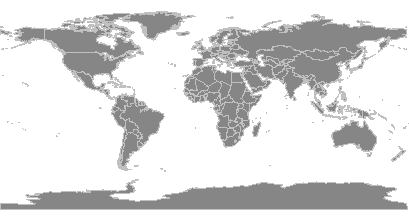
Most people are familiar
with the Mercator projection (below), a simple method of
flattening a globe. Greenland, Antarctica and other areas near
the poles are distorted, though, making them look huge. The part
of a Mercator coordinate system with the least distortion is a
belt along the equator.
To understand a Transverse
Mercator (TM) projection, imagine tipping the world coordinate
system sideways (transverse). The axis of such a map would go
through a couple opposing places on the equator, and the undistorted
strip (like that along the equator, above) would run north-south.
Cartographers using a TM projection shift that undistorted strip
around the globe in what they call zones.
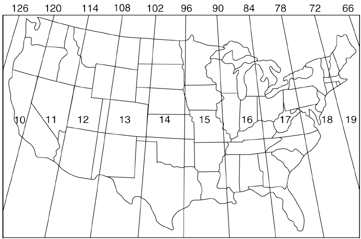
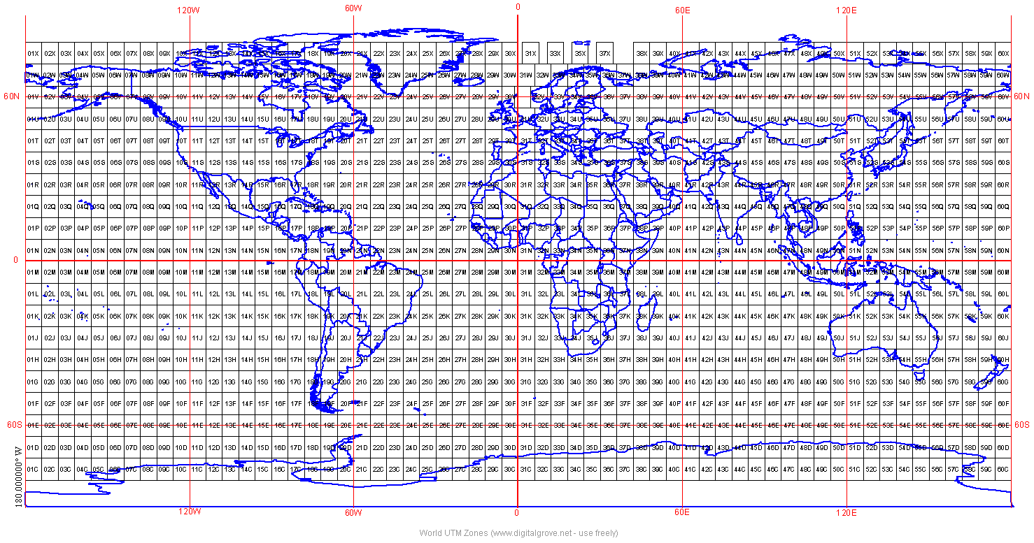
In a Universal Transverse
Mercator projection, each of the relatively distortion-free
zones is 6 degrees wide. Since the earth is 360 degrees around,
the UTM coordinate system has 60 zones world-wide. As shown
in the following map from USGS, the continental US falls between
UTM zones 10 and 19.
(Click
here for a
UTM Zone Map of the
world.)
So where did the term
"Universal" in UTM come from? The 60 zones and
standard coordinate numbering system used in UTM were established
by NATO in the 1950's as a mapping system for "universal"
military use.
To learn more about
the UTM coordinate system, check the
University of Colorado's web site.
|

 in the top TerraServerUSA menu bar. TerraServer then assembles
the image tiles into a view that you can save to your computer
by right-clicking it and giving it a file name. Make sure the
saved file has a "jpg" (not "jpeg") extension.
in the top TerraServerUSA menu bar. TerraServer then assembles
the image tiles into a view that you can save to your computer
by right-clicking it and giving it a file name. Make sure the
saved file has a "jpg" (not "jpeg") extension.
 Right-Click the link and choose to "Save Target
As", giving the target the same name as the view, except
use a "jgw" extension. Both the image file and the "jgw"
text file must be saved in the same folder. If saved correctly,
mapping programs like fGIS will open both the jpg and jgw files
simultaneously.
Right-Click the link and choose to "Save Target
As", giving the target the same name as the view, except
use a "jgw" extension. Both the image file and the "jgw"
text file must be saved in the same folder. If saved correctly,
mapping programs like fGIS will open both the jpg and jgw files
simultaneously.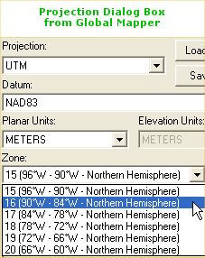