|
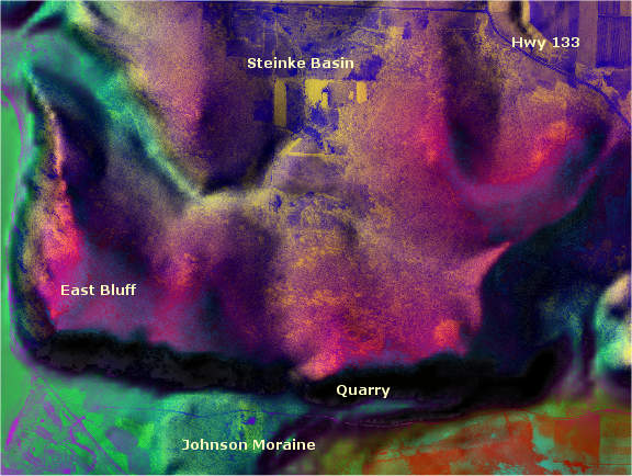
Version 4.74 of Global Mapper added advanced blending capabilities
to the rendering of raster data. The program can apply a variety
of Photoshop® style blends (i.e. Hard Light, Multiple, Screen,
Difference, etc.) to loaded elevation and raster data.
In this example, a 30-meter DEM and a grayscale orthophoto were
opened in Global Mapper. In the Control Center, the orthophoto
was texture mapped to the underlying elevation model using the
"Difference" blend option. The DEM was set to the Atlas
Shader color scheme. Paint Shop Pro was used to adjust contrast
and saturation and to add labels. The map site is located in Wisconsin's
Baraboo Bluffs.
ForestPal
Home
|