Global Positioning Systems - GPS
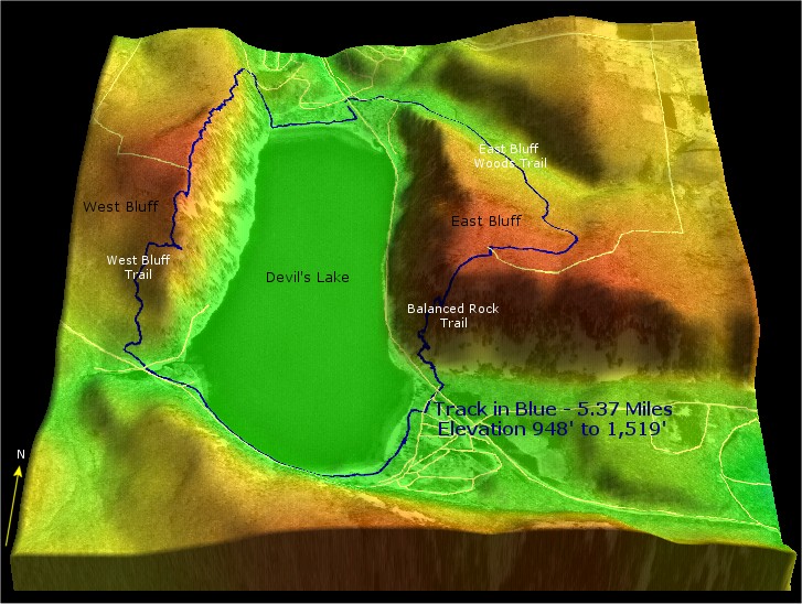
This 3DEM perspective view utilizes a transparent aerial photo overlay and elevation colorization produced in Global Mapper. The trails in blue were located using a recreational grade GPS receiver. 3DEM can directly read and map GPS data.
Return to ForestPal's Toolbox