|
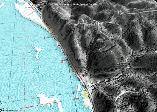
This
image was started with a scanned paper aerial photo. Paint
Shop Pro was used to combine the 2D scanned photo with a USGS
topographic map, using the state highway running along the river
as the transition line. (The map and photo were first adjusted
to matching scales, which can be accomplished by loading the two
bitmaps into separate layers and then stretching one layer until
it matches the other. The map of the river was then cloned into
the aerial photo.) The combined image was finally applied as an
overlay in 3DEM. Click
here for a full-sized 3D view.
Back
|
