|
To
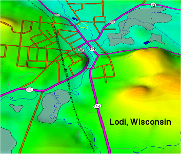
create a quick overlay that includes DLG data (like the roads
shown above) for use in 3DEM, follow these steps with the registered
version of Global Mapper:
-
Open a view in Global Mapper
and load all the data layers you wish to display. (Turn off
hill shading.) Position the screen with the zoom level you
want and then use "Capture Screen Contents to Image".
Save the image as a TIFF file with world file coordinates
at 2040x1264 resolution or higher. (Note: If you try to save
a GeoTIFF as the first step, Global Mapper will only capture
the background image, omitting the vector lines.)
-
Clear the Global Mapper screen
and then open the TIFF image file saved from the first step.
Use Global Mapper to export it as a GeoTIFF image with
24-bit color.
In
3DEM, load the Digital Elevation Model for the project and then
apply the GeoTiff from step 2 as an overlay. 3DEM will automatically
position the overlay for you.
Click here for a 2D Lodi DLG map for comparison.
Back
|